
The Conway National Park covers 22,500ha of land between Mackay and Bowen. It incorporates 35kms of coastline and covers a large peninsula, which is made up of the Conway Range.
The National Park surrounds the Whitsunday Passage, and offers great views out across the Whitsundays.
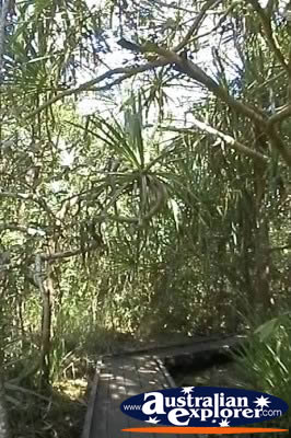
There is a diverse range of plantlife within the park, including open forest, mangrove canopy and tropical lowland rainforest. Many ferns and orchids can be found within the National Park as well as a wide range of animals. A common sight during the night are the adorable Proserpine Rock Wallabies.
There are a wide range of walking trails throughout the Conway National Park, which offer you the chance to experience the diverse landscape. Many of these start from around Airlie Beach and Shute Harbour
There are sign posts at the start of the walks, although you can also get information about the nearby Marine and National Parks from the Whitsunday Information Centre at Airlie Beach.
Conway National Park Walking Trails
Coral Beach Walking Track 1km one way
The Coral Beach Walking Track starts at Shute Harbour and travels through open forest to Coral Beach. Along the track you can get great views across Shute Harbour and the Whitsunday Passage. You can also wander to a ridge over Coral Bay, which offers views over the Molle Islands.
Circuit Track 1km circuit
The Circuit Track starts from the picnic area just outside of Airlie Beach (between Airlie Beach and Shute Harbour). It is a pleasant short walk, with an interesting information sheet at the start of the walking trail, which notes various points of interest along the way.
Haywood Gully 1.6km / 3.2km circuit
The Haywood Gully is a rewarding walking trail that starts from the picnic area just outside of Airlie Beach (between Airlie Beach and Shute Harbour).
Mt Rooper Walking Track 2.4km to lookout / 5.4km circuit
The Mt Rooper Walking Trail is a fantastic walking track, which gives great opportunity to see a variety of plantlife. On the way to Mt Rooper you will pass plenty of grass trees and wattles within the forest. Once you reach the Mt Rooper lookout, you will see fantastic views of the Whitsunday Islands and Whitsunday Passage. From this track there is also a 2km track which leads to the Swamp Bay track, where you will pass through rainforest areas, and also get great views of Swamp Bay.
Swamp Bay Walking Track 2.1km one way
The Swamp Bay Walking Track follows alongside the creek at the base of Mt Rooper. On arrival at Swamp Bay you will notice the coral covered beach, which has been washed up from the Great Barrier Reef. It is from here that you can get fantastic views of the Molle Group of Islands across the Molle Passage.
Conway National Park Accommodation
| SHARE with |
